Trails & Inspiration
The Somerset Three Peaks Circular Hiking and Walking Trail
Sian Lewis AKA The Girl Outdoors is a travel and outdoors writer, blogger and lover of adventures big and small. She is obsessed with finding new wild camping and wild swimming spots on her hikes and cycles around Great Britain and beyond. As part of the latest Haglöfs hiking campaign, she describes one of her favourite hikes around the Three Peaks in Somerset.
ㅤ
THE SOMERSET THREE PEAKS HIKE (17 MILES)
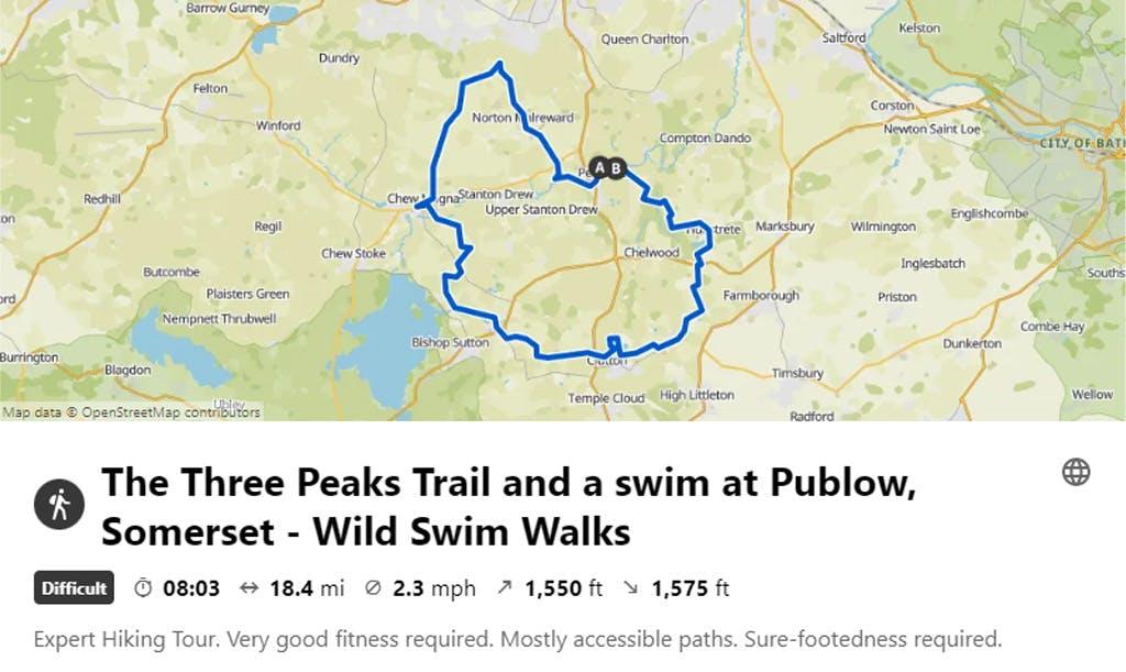
VISIT KOMOOT FOR A ROUTE MAP & MORE INFORMATION
ㅤ
ㅤ
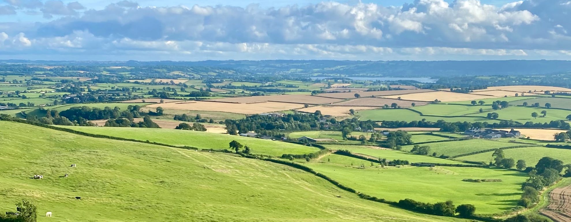
When you hear ‘Three Peaks’, you may first think of Yorkshire’s famed mountain walk up in the Dales. It might not be quite as rugged, but Somerset also has its own three peaks to conquer – Maes Knoll, Blackberry Hill and Knowle Hill which offer panoramic views of the Chew Valley and make for a wonderful 17-mile circular route that is easily accessed from either Bristol or Bath.
The Three Peaks Circular is a lovely (and still fairly hilly!) hike to take on if you fancy an all-day ramble across the Somerset countryside, and the route winds through wheat fields and woodlands and past the pretty villages of Chew Magna, Pensford and Clutton, with an optional stop for a swim in the Chew River.
ㅤ
ㅤ
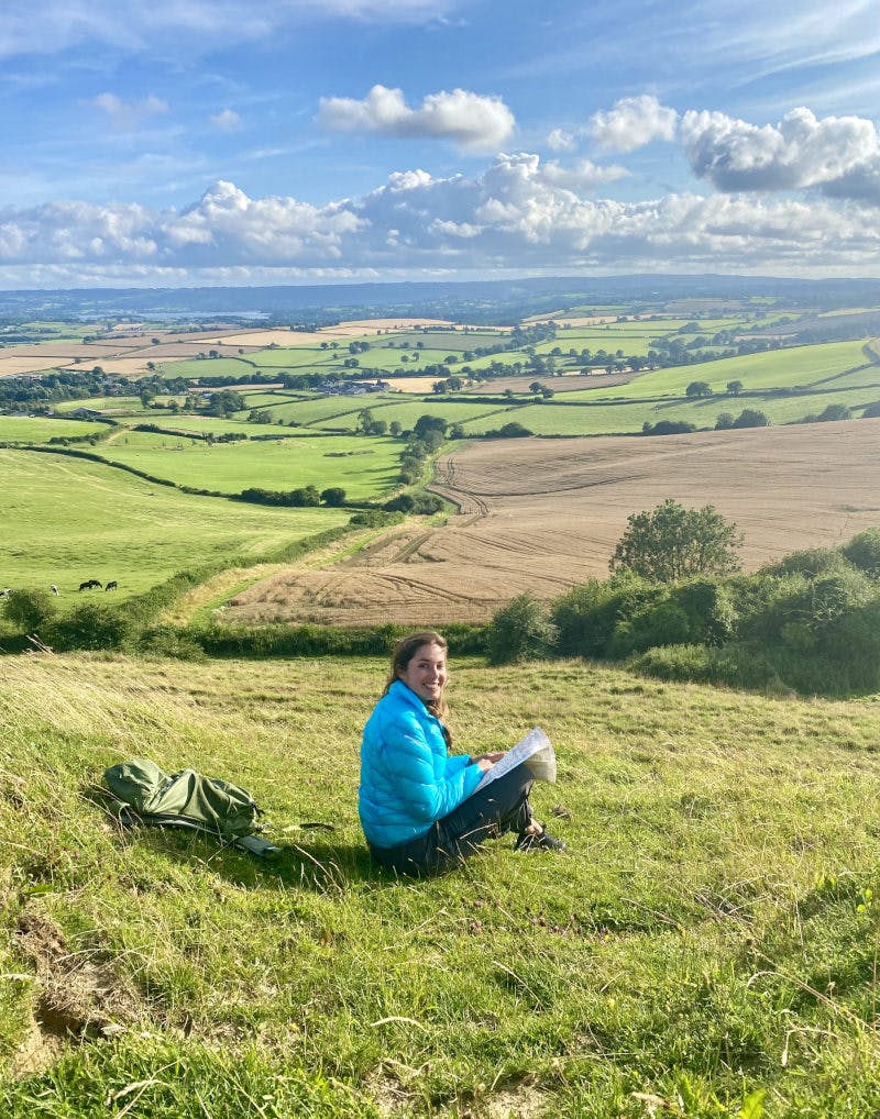
The terrain of this hike isn’t too challenging, mostly bridleways and woodland paths, but at 17 miles to complete, this circular route does take a fair few hours to cover. I recommend giving yourself 6-8 hours, especially if you fancy stopping off for a picnic on one of the hills for lunch with a view, or popping into one of the villages along the way for a spot of food.
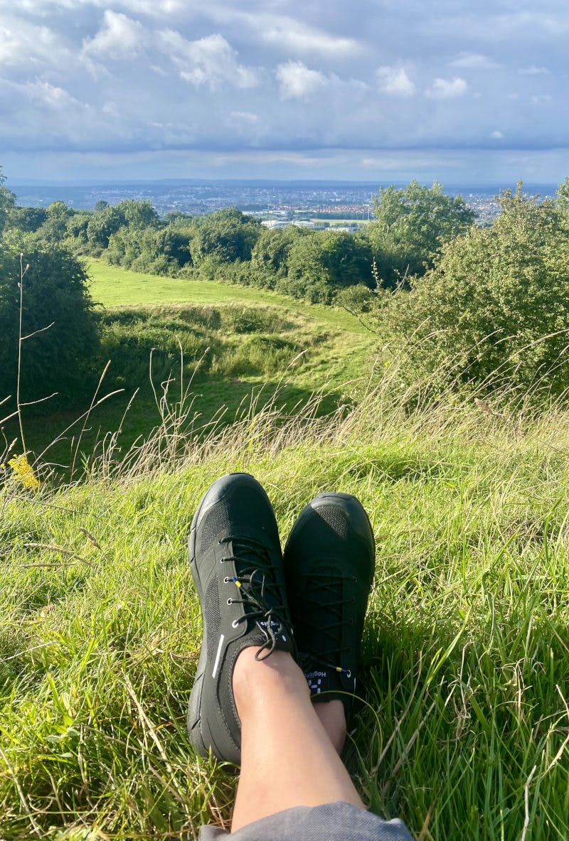
I recommend starting and finishing the Three Peaks Circular in the hamlet of Publow - there’s a great little swim spot in the Chew River under the village bridge here, ready and waiting for a cooling dip when you finish up the walk. Starting here and walking the route anticlockwise, you pass under Pensford’s soaring viaduct and cut across fields to reach the first hill of the day, Maes Knoll. The knoll is a lofty spot (at least by Somerset standards! It’s 197 metres tall). Climb up and you’re rewarded with big views of the Chew Valley below, and east to Bath and the Cotswolds hills from one side. You can look down on the sprawl of Bristol from the other. This is a storied spot – Maes Knoll is actually the remains of an Iron Age hill fort, constructed as a defensive site back in 250 BC, and in World War II the Home Guard were stationed here as lookouts over the city of Bristol.
From here the path winds its way into the postcard-perfect village of Chew Magna. This is my favourite place for a pit-stop on the walk – call in at Jars Café for coffee and a sandwich or pop to the Bear and Swan pub if you’re in the mood for a quick mid-hike pint. Then make your way to Knowle Hill, which has sweeping views of Chew Valley Lake. This peaceful spot feels very wild thanks to its surrounding trees and tall ferns and grasses – I often spot butterflies, and sometimes wild deer, here.
ㅤ
ㅤ
Pass through Clutton to tick the last hill of the day, Blackberry Hill, off your list – there’s some hefty inclines to be had around this section of the walk, but you’ve broken the back of the route by this point. Towards the end of the walk you’ll pass through the welcome shade of Lord’s Wood at Hunstrete, and a peaceful woodland trail takes you most of the way back to Publow, where you can cool tired hiking feet in the River Chew. The Rising Sun in Pensford is a few minutes away if you want to toast your Somerset hiking adventure with a beer or two.
ㅤ
Follow Sian on komoot and check out the Somerset Three Peaks walk here.
Sian is wearing shoes and apparel from the Haglöfs L.I.M range.
SHOP THE HAGLOFS L.I.M COLLECTION HERE
ㅤ
Searching for more inspiration?
Join our SportsShoes komoot community for more fantastic route guides and handy hiking advice.
ㅤ
Please note: Wherever possible, we advise that you carry a relevant map and compass as your primary source of navigation, especially when undertaking long and exposed routes on new and unfamiliar territory. GPX files and digital mapping should only be used as an additional navigational aid, as signal can easily be lost and batteries can fail. Check out our guide for more detailed information about how to stay safe when trail running and hiking.
ㅤ
Join our Sportsshoes x komoot community now to find inspiration, plan outdoor adventures and share your stories. Because it's no fun standing still.
Check out our Trails and Inspirational category to discover the most amazing trails and hikes in the world, as recommended by our athletes, ambassadors and loyal customers.
Welcome
Discover some of the best trail running spots and locations the world has to offer, handpicked for you by the experts at SportsShoes.com.