UK's Best Walks and Hikes Part 3: The Ullswater Way
In part 3 of our series featuring the UK’s best walks and hikes, outdoor enthusiast Mel Sykes, tells us about her walk around the Ullswater Way in the Lake District.
ㅤ
VISIT KOMOOT FOR A ROUTE MAP & MORE INFORMATION
ㅤ
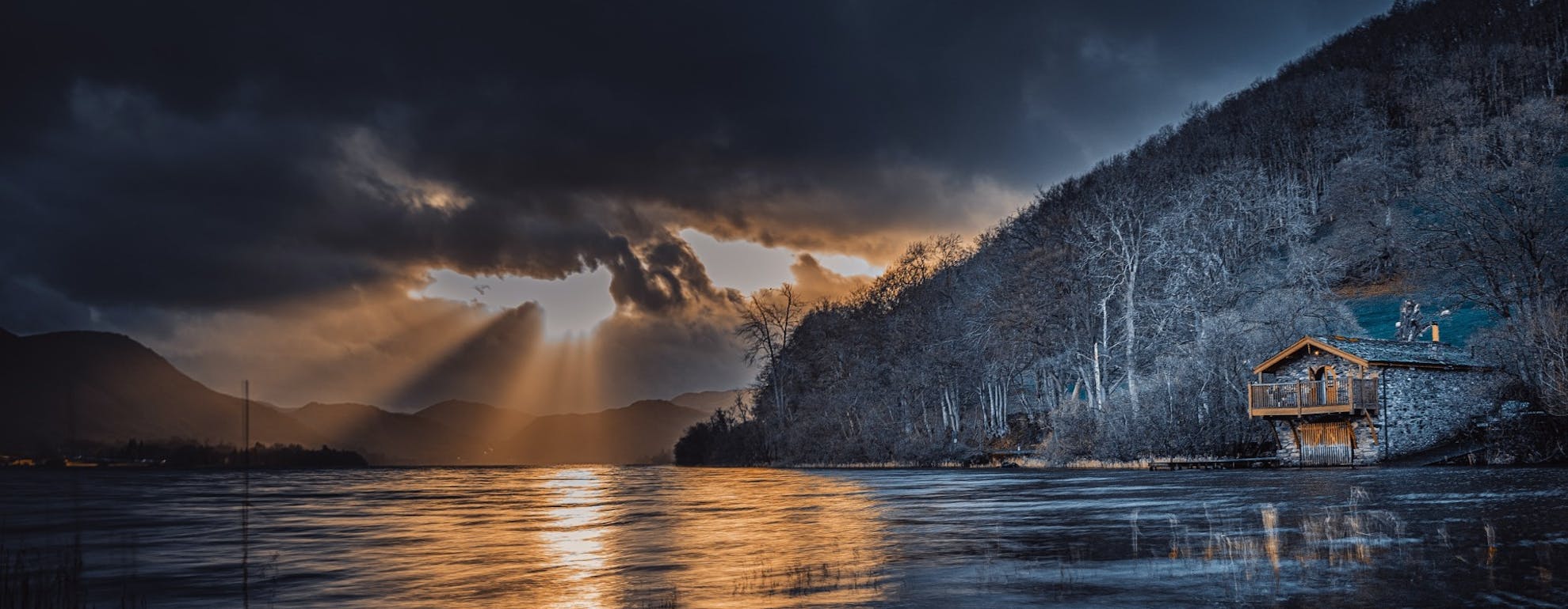
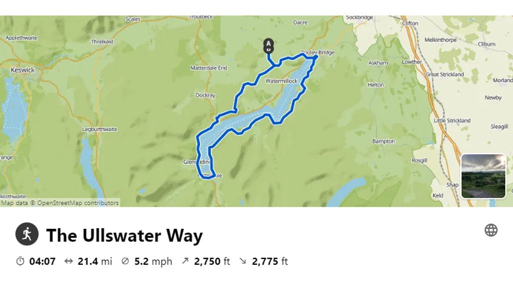
The Ullswater way is a 20-mile circular loop around Ullswater in the Lake District. It can be walked/run in any direction in either one loop or by breaking it down into smaller sections by utilising the Ullswater steamers to access drop-off points around the lake.
It’s a really well signposted route and also has additional sections where you can leave the official route to visit waterfalls, find places to eat and climb extra fells. The small Ullswater Way plaques are easy to spot, which makes it simple to navigate and plot out yourself. I ran this route as a training run for a longer event that I was doing in September, so set off from my Airbnb and headed anti-clockwise around the lake.
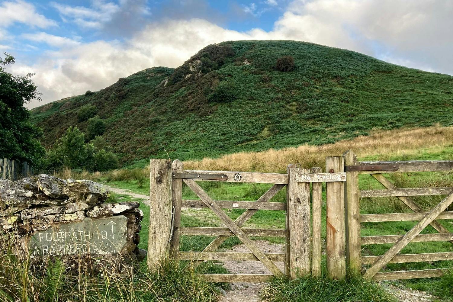
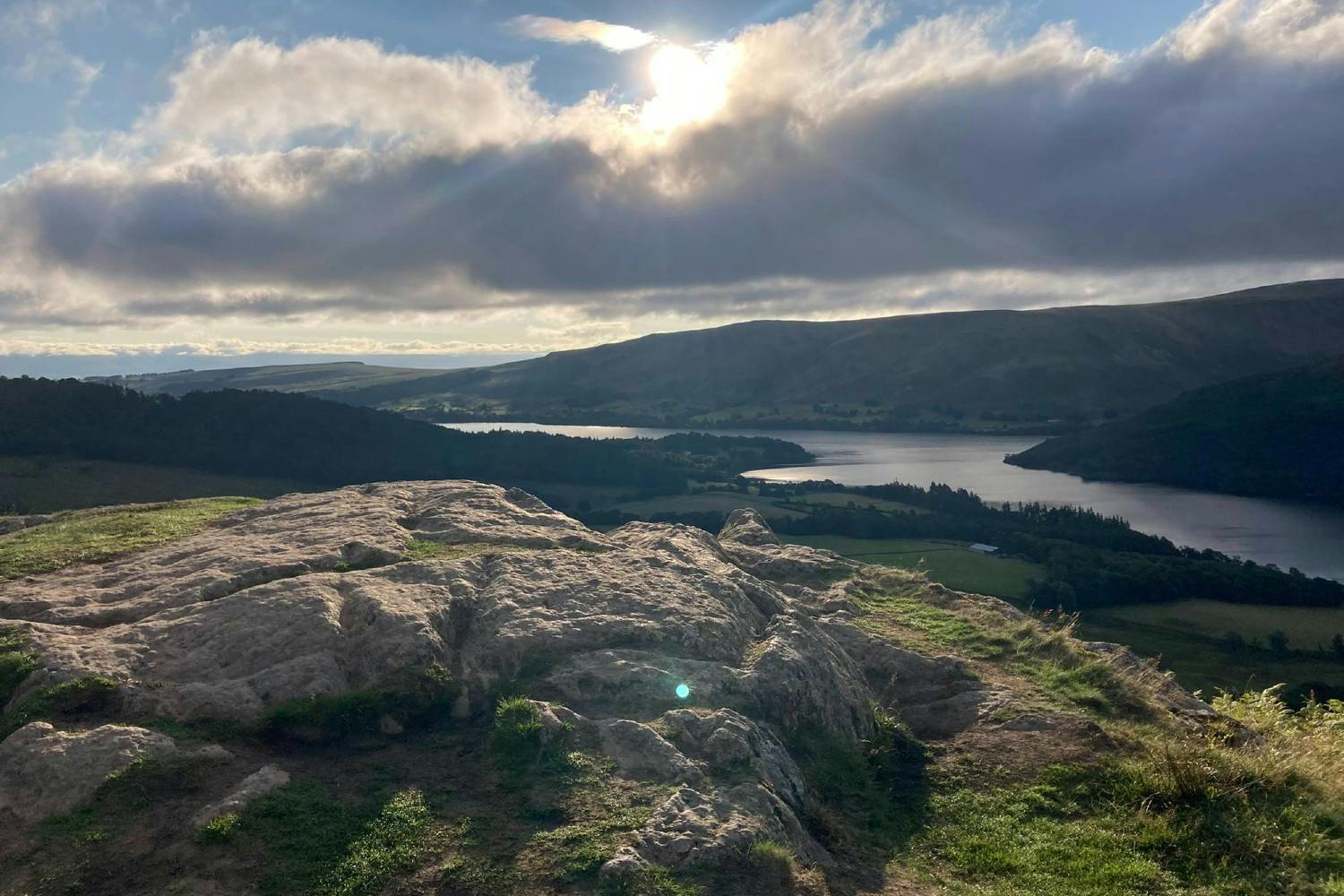
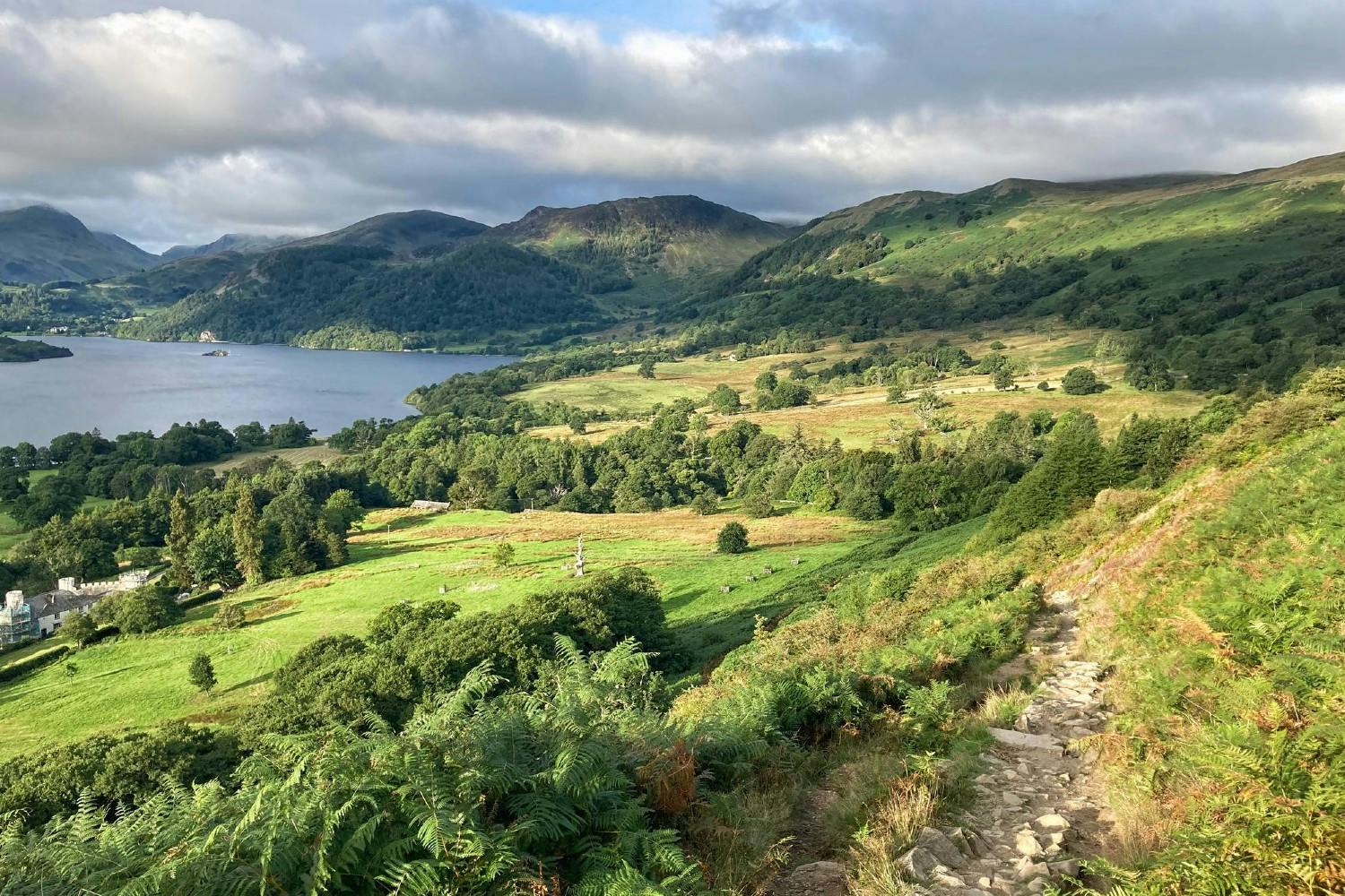
I joined the route at Bennethead and set off along what happens to be part of the Montane Lakeland 100/50 route, which is an event that runs in July each year. The first section from Bennethead takes you through a forest on a well-trodden path which winds its way through Swinburn park before coming to a split junction where you can either head up Gowbarrow fell or follow the path along the ridge via Yew Crag to Aira Force waterfall. I took the ridge path which, on a clear August morning, made for a wonderful view of the lake.
ㅤ
ㅤ
After passing through the carpark at the foot of Aria force waterfall you then join a path along the side of the main road to Patterdale at the most southerly tip of the lake. This path is undulating and narrow and can be busy during the middle of the day as it’s the only access down to the bottom section of the lake which avoids the road. You then have a small road section until you reach Patterdale where you take a left turn through a farm along a dusty track that leads to the campsite at Side Farm.
The next section of the route was lovely and quiet when I ran it in the early morning. It follows the edge of the lake which I presumed would be nice and flat - I was very wrong! It turned out to be undulating and technical and you have to have your wits about you as you step up and down over outcrops and slate rocks and boulders. It’s a really great section of the route and keeps things interesting.
ㅤ
ㅤ
You soon drop down to lake level and the isolated beach area of Sandwick Bay comes into view. If you’re in the area for a few days then spending a day here is great in summer as it has easy access to the water for swimming and paddle boarding, whilst also avoiding the crowds.
Once through Howtown, where the steamer drops off, you head up the Western side of the lake which has a little bit of everything in terms of terrain. There are wide tracks, a technical part through the woods where you have to watch out for tree routes, and some grassy footpaths across the fields. One thing I did notice on this section was the large amount of stiles/gates that there are. You feel like you’re constantly stopping and starting so it’s hard to get into any sort of rhythm but it does give you a chance to enjoy the wonderful views.
If you so desire you can also ascend both Bonscale Pike and Arthur’s Pike from here which are both well signposted from the route.
ㅤ
ㅤ
The trail then continues along some higher footpaths, crossing through grassy fields, before dropping you back down to the road and the water’s edge through a large campsite which can make this part of the route quite busy, especially in peak season. You then arrive in the popular town of Pooley Bridge. This is a great place to stop for refreshments and there are a couple of drinking water taps available to refill water bottles which are dotted around the campsite.
Once out of Pooley Bridge you begin to ascend away from the road, through more fields and through more gates, until you reach Maiden Castle before joining the road and back in Bennethead from where you started.
(An alternative/additional loop from Pooley Bridge takes you via the Dalemain estate, which has a cafe and free parking available)
I’d recommend doing this route on a clear day to make the most of the views and also start it early (especially if running), as some of the sections are single path and it can be busy with walkers.
All in, it’s a great circular route with options to extend if needed and a few spots for water top ups and refreshments.
ㅤ
Photos: Mel Sykes
Follow Mel and all her outdoor komoot adventures here.
ㅤ
Join our Sportsshoes x komoot community now to find inspiration, plan outdoor adventures and share your stories. Because it's no fun standing still.
Check out our Trails and Inspirational category to discover the most amazing trails and hikes in the world, as recommended by our athletes, ambassadors and loyal customers.
Welcome
Discover some of the best trail running spots and locations the world has to offer, handpicked for you by the experts at SportsShoes.com.